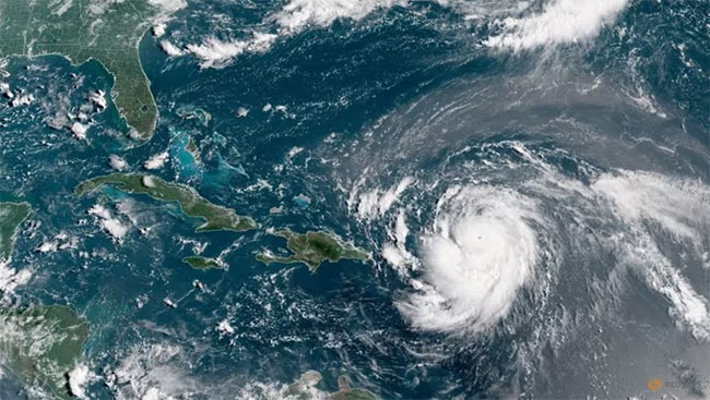
Hurricane Erin, the first hurricane of the 2025 Atlantic season, has become a catastrophic Category 5 hurricane, the US National Hurricane Center said on Saturday (Aug 16).
The storm is currently 170 km north of Anguilla, with maximum sustained winds near 255 km/h.
The NHC said on Friday that Erin is expected to strengthen over the southwestern Atlantic through the weekend and into next week.
Swells generated by Erin will affect portions of the northern Leeward Islands, the Virgin Islands, Puerto Rico, Hispaniola, and the Turks and Caicos Islands through the weekend, the NHC said earlier on Saturday.
The swells will spread to the Bahamas, Bermuda and the East Coast of the United States early next week, it said.
Erin has also raised concerns about another unforeseen risk, wildfires. Andrew Siffert, a senior meteorologist at BMS Group, noted that if Erin evolves into a large, intense extratropical cyclone offshore, a dangerous alignment could occur, critically dry fuels across the region, strong and dry winds driven by Erin’s pressure gradient and human ignition sources.
ILS investment manager Twelve Securis said on Friday that Erin is forecast to remain far enough offshore to spare the US East Coast from significant impacts.
The storm is projected to pass north of the northern Caribbean Leeward Islands before turning north between the US East Coast and Bermuda around Monday.
Erin is expected to produce areas of heavy rainfall through Sunday across the northern Leeward Islands, the Virgin Islands and Puerto Rico, the NHC said.
Source: Reuters
– Agencies


